by A’mya Price
Baton Rouge is a city layered in stories—some celebrated, others long forgotten. Beyond the landmarks and levees lies a history rarely discussed openly: the lives and labor of enslaved people who helped build the city’s foundations. While their stories are often buried beneath concrete and silence, they shaped the landscapes we travel through daily.
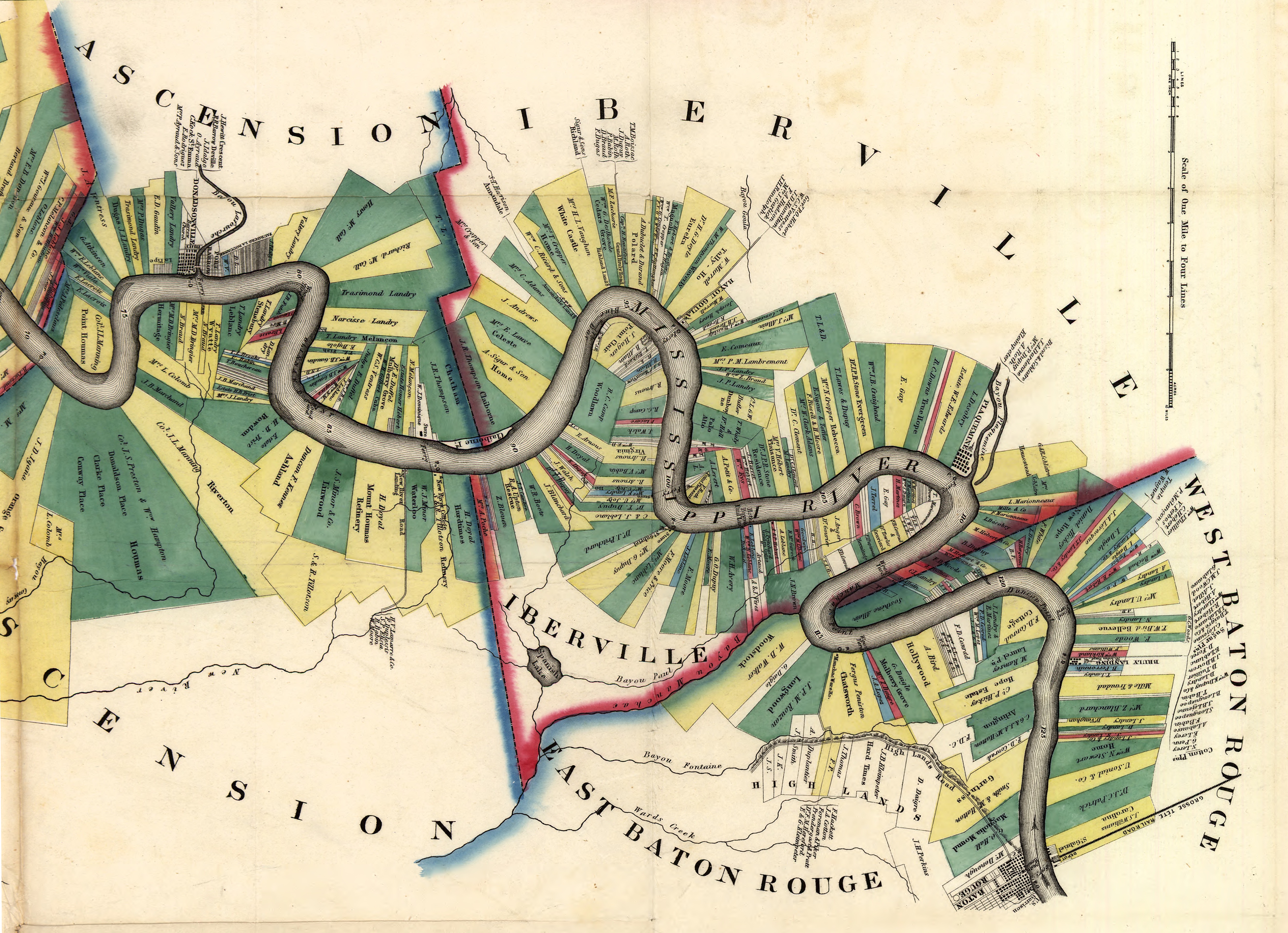
This interactive map titled “The Story of Those Who Came Before” is an effort to recover those voices and spaces. It highlights key sites of slavery in Baton Rouge—from plantations and slave markets to sites of resistance and transformation—offering users a chance to navigate the past through the lens of place.
Slavery in Baton Rouge: A Brief History
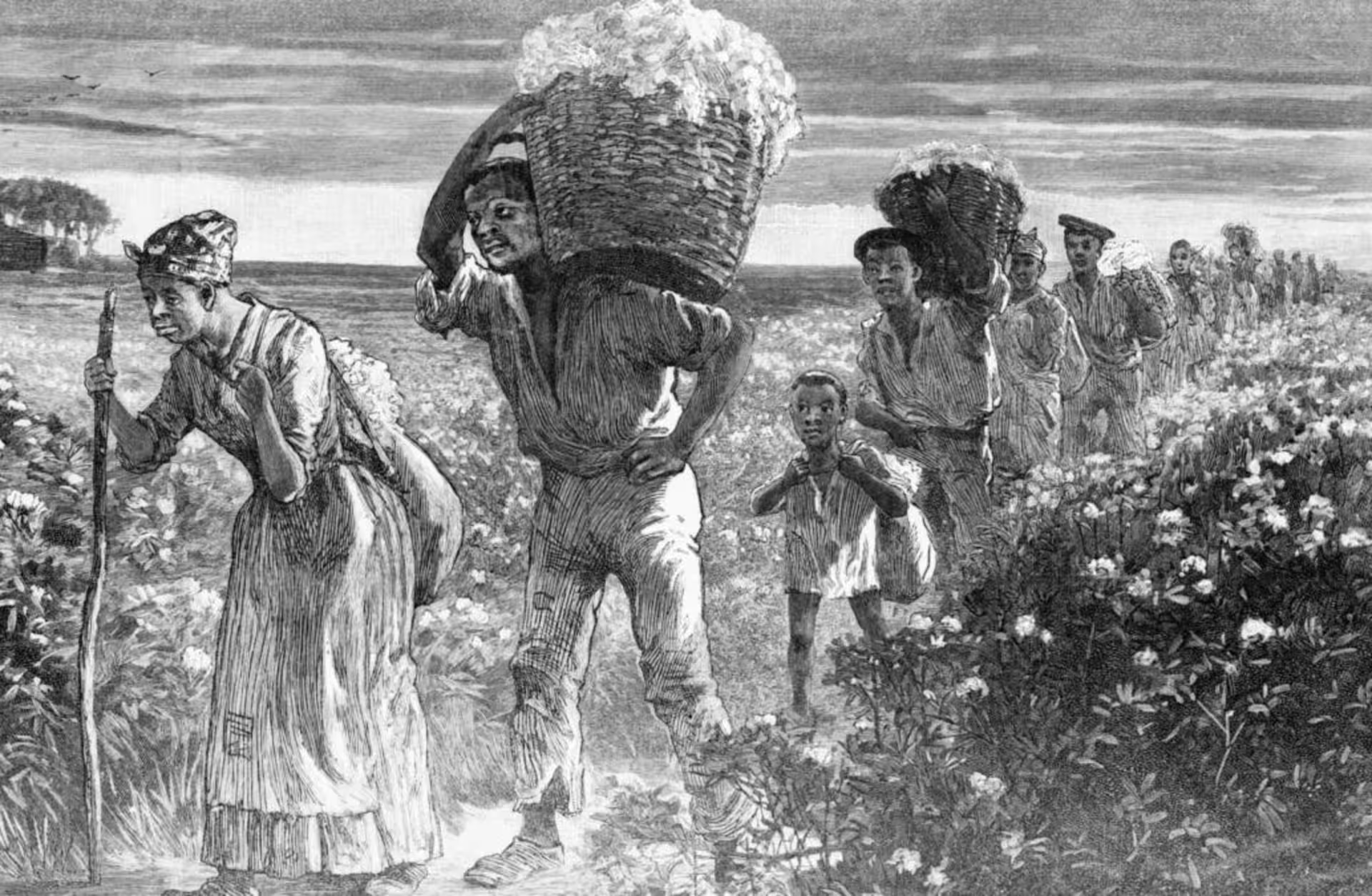
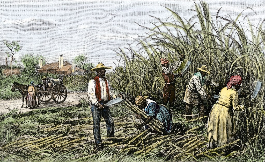
As the capital of a plantation-dominated state, Baton Rouge played a significant role in the domestic slave economy of the 18th and 19th centuries. Enslaved individuals labored on sugar and cotton plantations, constructed buildings, worked as blacksmiths and cooks, and were bought and sold on the city’s streets. Even after emancipation, the legacy of slavery lingered in social, political, and economic structures.
Yet these histories are rarely commemorated in public space. Many slave markets were repurposed, and the names of enslaved people were often omitted from records. This map is an attempt to reverse that erasure by grounding history in the very spaces where it unfolded.
Featured locations on the Map
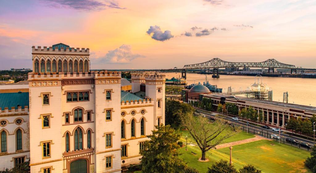
1. Magnolia Mound Plantation – 2161 Nicholson Drive
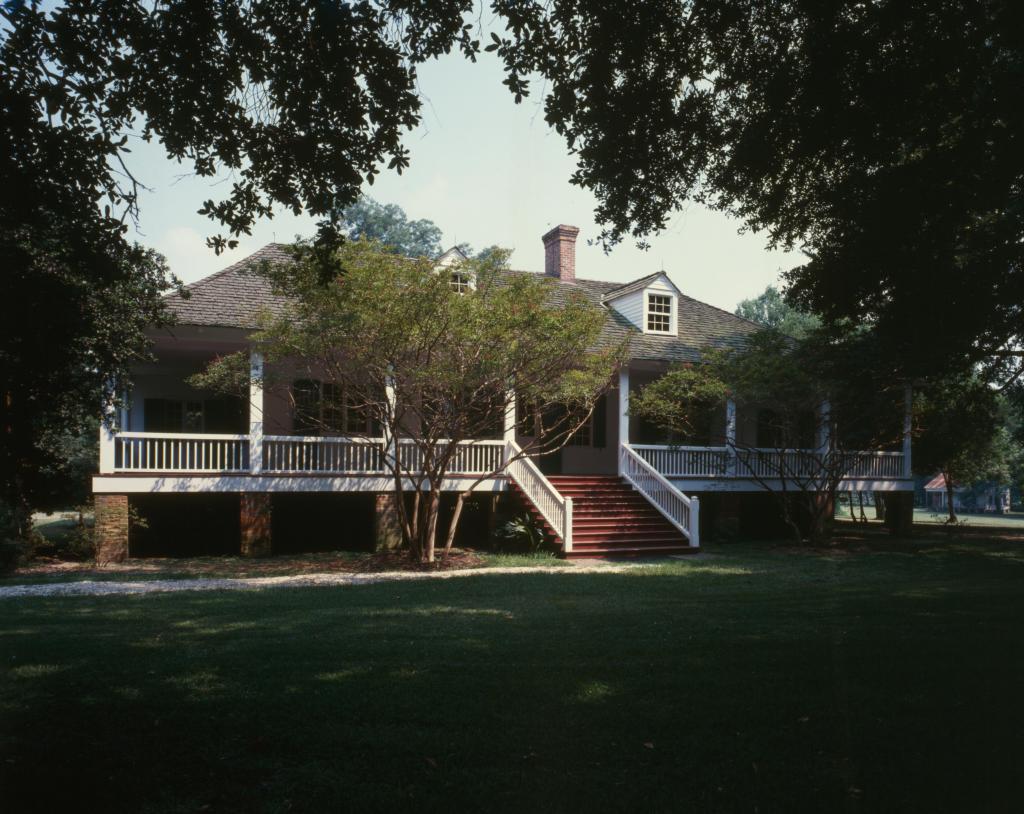
One of the oldest preserved plantation homes in Baton Rouge, Magnolia Mound was built in the 1790s. The estate once housed dozens of enslaved men, women, and children who worked the land and served in the household. Visitors today can see the restored slave quarters, offering a rare window into the lives of those forced to labor in silence. The story of Nancy Hill, an enslaved woman who lived here, is one of the few personal histories that have survived, underscoring both the humanity and suffering of those who lived under bondage.
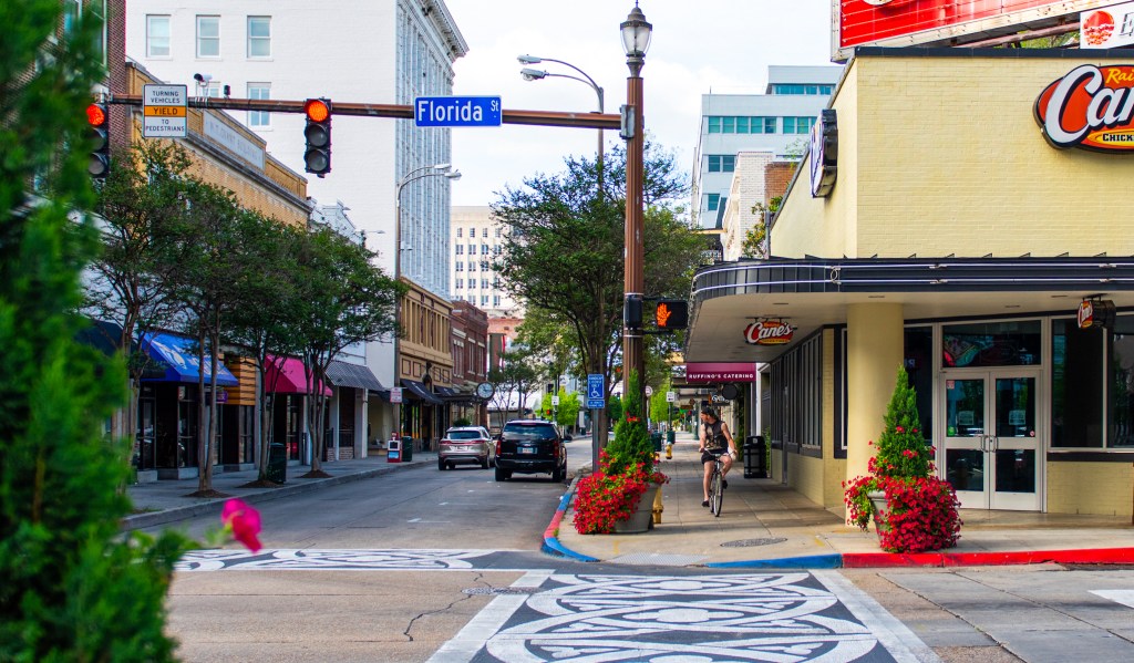
2. Florida Street Slave Market – Downtown Baton Rouge
Near the old courthouse, Florida Street was once home to public slave auctions. Although no marker commemorates this painful history, 19th-century newspapers and court documents confirm its use as a trading ground for enslaved people. Today, the bustling cityscape masks what was once a center of human trafficking. This map overlays historic sources onto modern streets to visualize the transformation—and erasure—of memory.
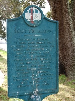
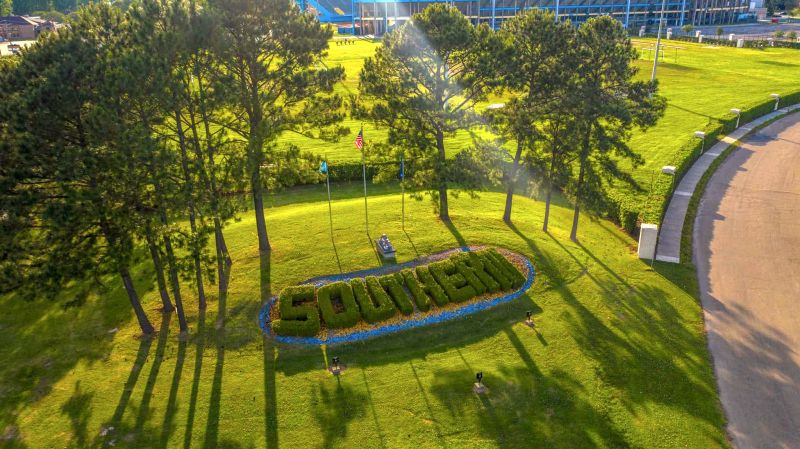
3. Scott’s Bluff and Southern University
Overlooking the Mississippi River, this site speaks to both oppression and progress. While the land once bordered areas tied to enslaved labor, it now hosts Southern University, a historically Black college founded in the post-Civil War era. The university represents a powerful reversal: from slavery to self-determination, education, and empowerment. However, today Scott’s Bluff faces environmental threats from riverbank erosion, reminding us that both land and memory require active preservation.
Why Mapping Matters
Maps do more than chart physical space—they chart power, memory, and truth. By visually restoring places erased from public history, this project confronts the legacy of slavery head-on. It asks us to remember not just the names of the enslavers or the mansions they built, but the laborers whose hands laid the bricks and tilled the soil.
Interactive storytelling helps bridge the gap between past and present, inviting viewers to move through history, not as distant observers but as engaged witnesses. This map was built not only to educate—but to honor.
What You Can Do
- Explore the Map: Navigate the landmarks, examine archival materials, and follow the geographic threads of slavery in Baton Rouge.
- Visit Sites in Person: Walk the streets of Florida Blvd, tour Magnolia Mound, or stand at Scott’s Bluff and reflect on its layered legacy.
- Preserve Memory: Support historical preservation efforts and push for public recognition of sites tied to enslaved people.
Explore the full interactive map here: “The Story of Those Who Came Before”
History leaves traces—sometimes in buildings, sometimes in soil, and sometimes in silence. With this project, we invite Baton Rouge to listen to the stories the land still holds.
Sources and Further Reading
Magnolia Mound Historical Records – Friends of Magnolia Mound
Down by the River: A History of the Baton Rouge Riverfront – U.S. Army Corps of Engineers
Louisiana Slave Sale Advertisements – 64 Parishes / Louisiana Digital Library
Historical Marker Database – Scott’s Bluff – HMdb.org
Southern University Erosion Crisis – Louisiana Illuminator (2021)